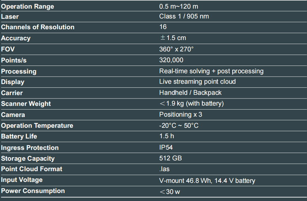


The Cygnus 2 LiDAR scanner delivers industry leading accuracy and performance, utilizing cutting edge LiDAR and visual fusion SLAM. Designed for precision and reliability, it ensures centimeter-level positioning accuracy in environments where accurate location data is crucial, and excels in real-time tracking in GPS-denied areas.

Unmatched Accuracy
Achieve precision with 1.5 cm accuracy through advanced GNSS RTK andvisual SLAM integration.
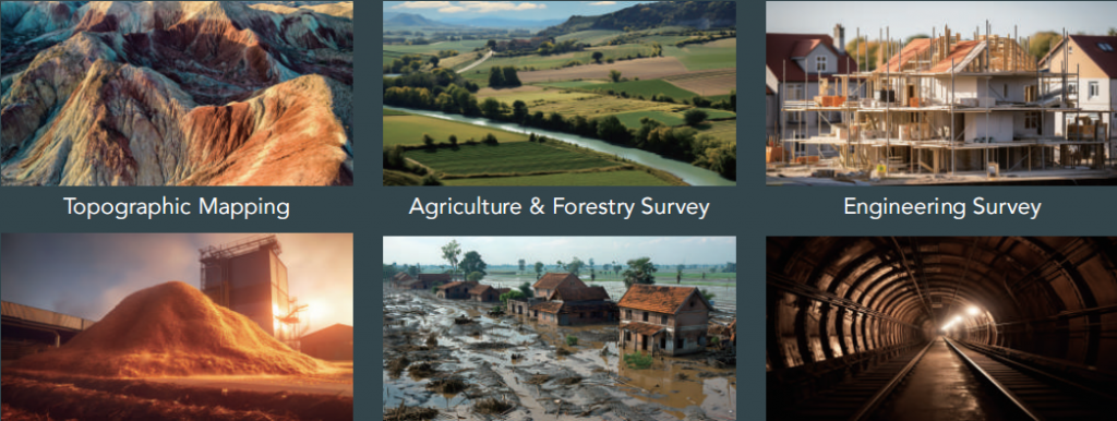
Versatile Applications
Ideal for construction, surveying, mapping, agriculture, forestry, engineering, volume calculation, and emergency mapping.
Multi-Mode Point Cloud
Enhanced project efficiency with various map fusion methods, control points RTK, and breakpoint resume scanning.
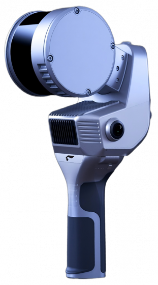
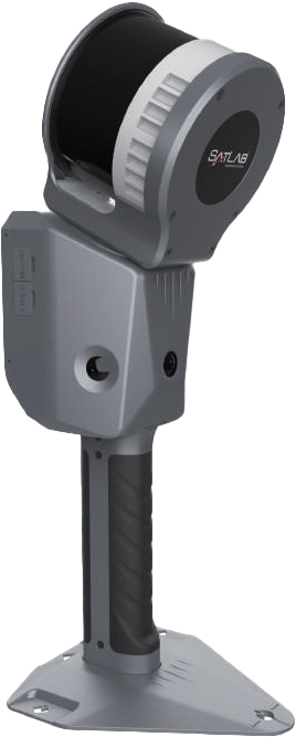
Portable and Lightweight
Weighing only 1.9 kg with a 90-minute battery life, it’s perfect for large projects and reduces operator fatigue.
Real-Time Processing
Instant 3D modeling and data export with powerful processors and advanced SLAM algorithms.
Software
- Desktop Processing Software & Mobile APP
The software offers comprehensive tools for real-time point cloud data processing, including:
3D Modeling and Viewing:
Real-time visualization and post-processing capabilities.
Data Management:
Point cloud optimization, geo-referencing, colorization, cropping, and volume calculation.
Device Control:
Seamless device acquisition, live-streaming point cloud, and device status monitoring.
Benefits
Enhanced Detail and Precision:
Capture high-density point clouds with 1 cm thickness for superior data visualization and feature identication.
Efficient Operation:
Streamline large-scale projects with advanced scanning and processing technologies.
User-Friendly Design:
Easy one-button operation with integrated high-precision IMU, high-performance data logger, and clip-in battery for quick setup and use.
Applications
Specifications