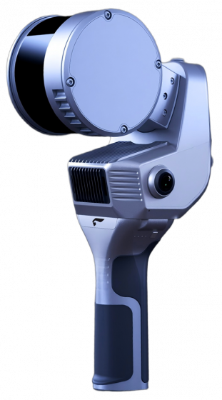


GS-120G 32-Line
HandHeld Lidar Scanner
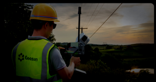
The GS-120G features a minimalist design, offering easy operation and flexible installation. supporting multiple platforms and modes, it is equipped with a 360° rotating head, allowing for a 270° x360° point cloud coverage. The device includes a high-definition camera and an RTK module. combined with industry-grade slam algorithms, it can seamlessly capture high-precision colored point cloud data of the surrounding environment both with and without GNSS support, without the need for external devices

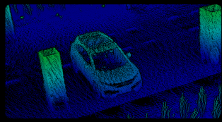
Real-Time Colored
Point Cloud

32 Channel
Rotating LiDAR

Self-Developed
Efficient Algorithms

Suppor RTK-SLAM
and Pure SLAM

One-Cick Data
Processing Software
Real-time point cloud for detailed control
Real -time colored point cloud preview via the app

self-developed algorithms enable efficient tasks
No closed loop needed and system auto-shuts after
completion.
Seamless positioning with RTK+SLAM
enabling operation whether GNSS signals
are available or not.
SPECIFICATIONS
- General System Performance
- POS Performance
| Absolute Accuracy | ≤5cm | Relative Accuracy | ≤1.5cm | |
| Battery Duration | 2h | Weight | 2.2kg | |
| Operating Temperature | -20℃~55℃ | Power Consumption | 25W | |
| Data Storage | 128G SD Card | Battery Capacity | 11600mAh (internal battery) | |
| Carrying Platform | Handheld/Backpack/Airborne/Vehicle | 19000mAh (External battery) |
| Position Accuracy | 0.02m horizontal, 0.03m vertical | GNSS system | GPS L1/L2/L5 GLONASS L1/L2; BDS B1c/B1/B2/B2a/B2b/B3; GALILEO E1/E5b/E5a |
|
| Pich/Roll Accuracy | 0.015° | |||
| Heading Accuracy | 0.040° |
| Measuring Range | 120m | Range Accuracy | ±1.5m | |
| Laser line Number | 32Line | Data dua echo | 1280,000 Points/Sec | |
| FOV | 270°×360° | |||
| Camera Resolution | 3×5 MP |
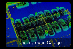
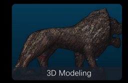
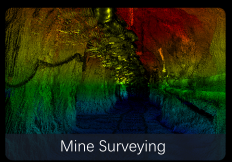
APPLICATIONS