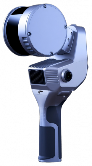


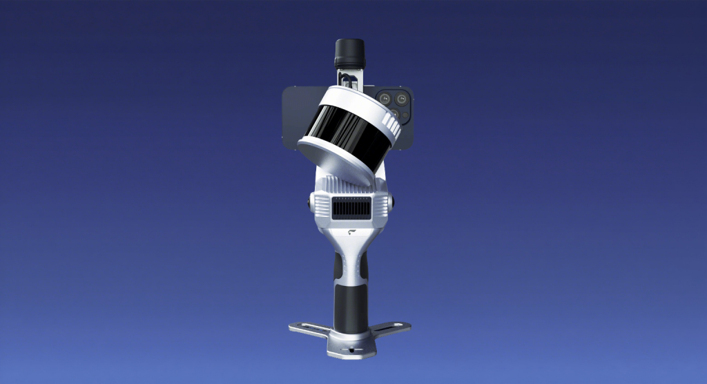
The SLAM200E combines the distinctive features of both the SLAM100 and SLAM200 models. Equipped with a high-frequency laser sensor, dual 12-megapixel panoramic cameras, an integrated high-precision GNSS module, and a powerful computing unit, this scanner delivers a brand-new experience in spatial data acquisition for users.
In addition, SLAM200E introduces several proprietary innovations from Feima, including data breakpoint resumption, aerial point cloud data fusion, and high-fidelity 3DGS reconstruction. A newly launched SLAM Instant APP further allows instant mapping upon survey completion, meeting the needs of industries that require rapid on-site reporting and significantly improving work efficiency.
Product Features
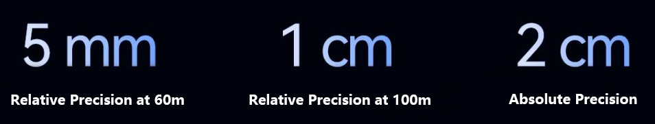
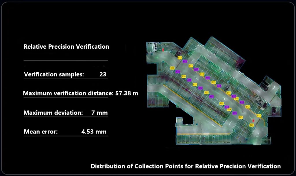
Supporting ultra-high precision measurement
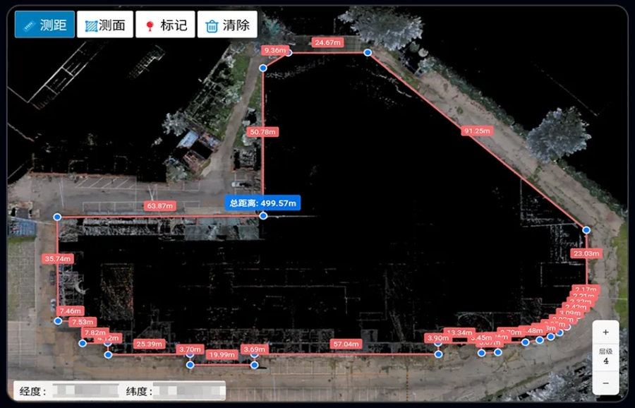
the SLAM200E, as a professional-grade mobile mapping tool, can achieve a relative accuracy of 5 mm within 60 meters and 1 cm within 100 meters. When connected to RTK or using control points, it is capable of delivering an absolute accuracy of 2 cm for high-precision surveying.
Support for Absolute Reference Real-Time Mapping
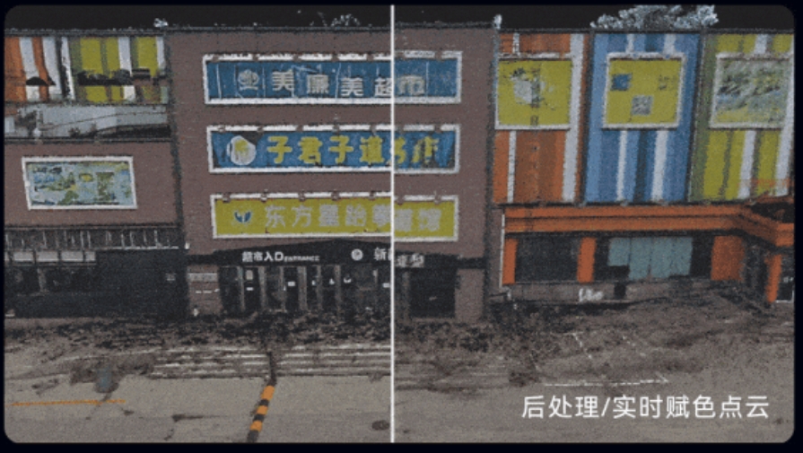
The SLAM200E generates high-precision, real-time colored point clouds, delivering results that are both intuitive and detailed. When connected to RTK, it can directly output point clouds with absolute coordinates, greatly enhancing operational efficiency. In most typical application scenarios—including but not limited to urban mapping and engineering monitoring—it enables real-time point cloud acquisition, significantly reducing the post-processing cycle.
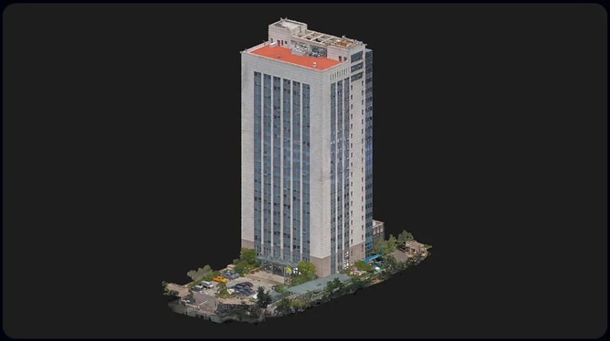
Support for High-Precision 3D Scene Reconstruction
By combining high-accuracy point clouds with high-resolution image textures, the SLAM200E enables precise 3D scene reproduction. It meets the demanding 3D data acquisition requirements of applications such as digital factories, virtual exhibitions, and BIM.
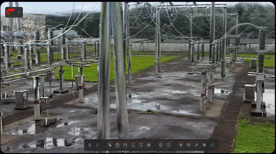
Support for Panoramic Camera Integration
The dual 12-megapixel panoramic cameras capture 360° wide-field imagery and detailed texture information, enabling the generation of more realistic colored point clouds and panoramic images. The panoramic camera data can be applied to point cloud coloring, visual SLAM, panoramic image generation, 3D mapping, Gaussian splatting, and more.
New Features
Instant Measurement
Converting massive point cloud data into final survey results typically requires professional post-processing software, skilled operators, and significant office time. Feima Robotics’ SLAM Instant APP provides instant measurement solutions for multiple scenarios, enabling users to quickly generate industry reports on-site right after acquiring point cloud data in the field.
Aerial-Ground Data Fusion
While handheld laser scanners can efficiently capture above-ground and underground 3D data, certain application scenarios still require supplementary aerial point cloud data. Feima Robotics provides users with an aerial-ground fusion algorithm based on both handheld and airborne modes of the laser scanner, integrating 3D point cloud data, imagery, and 3DGS data into a unified solution for seamless aerial-ground integration.
Gaussian Splatting
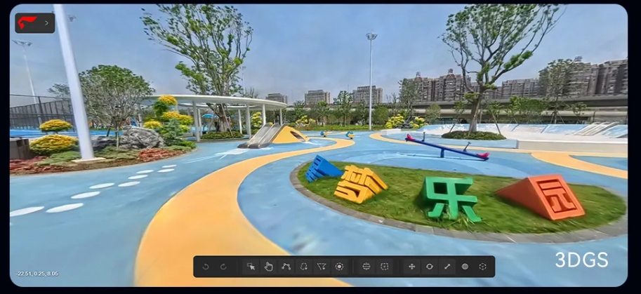
The SLAM200E enables large-scale Gaussian splatting data generation, visualization, and application based on panoramic imagery. Both the final results and process data are provided in standard formats, ensuring easy integration with other application platforms. The Gaussian splatting function based on the handheld laser scanner is available for free, for lifetime use.
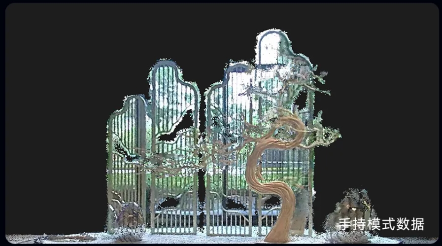
Static Station Mode
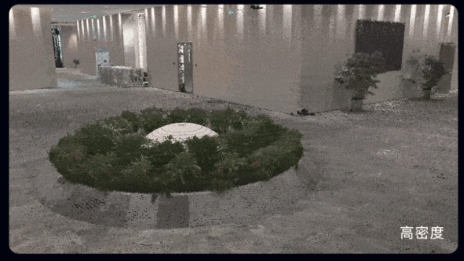
The static station mode effectively eliminates errors caused during handheld scanner movement, enabling the efficient capture of high-precision, high-detail, and high-density 3D point cloud data in challenging environments. It also supports collecting data from specific viewpoints as required by clients, with automatic stitching and optimization of static station data to further enhance data quality and processing efficiency.
Supporting Software
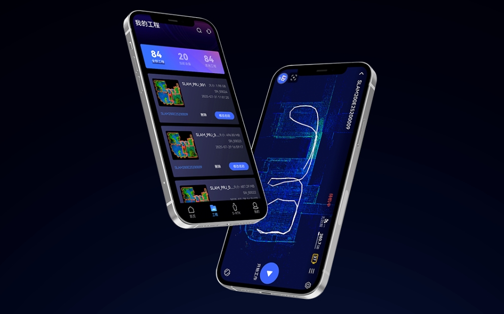
SLAM GO APP
The SLAM GO APP is the dedicated data acquisition app for Feima Robotics’ entire series of handheld laser scanners, fully compatible with both Android and iOS systems. The app establishes a stable connection with the SLAM200E via Wi-Fi, and the SLAM200E can share the phone’s data network. It provides convenient acquisition controls and powerful result management features.
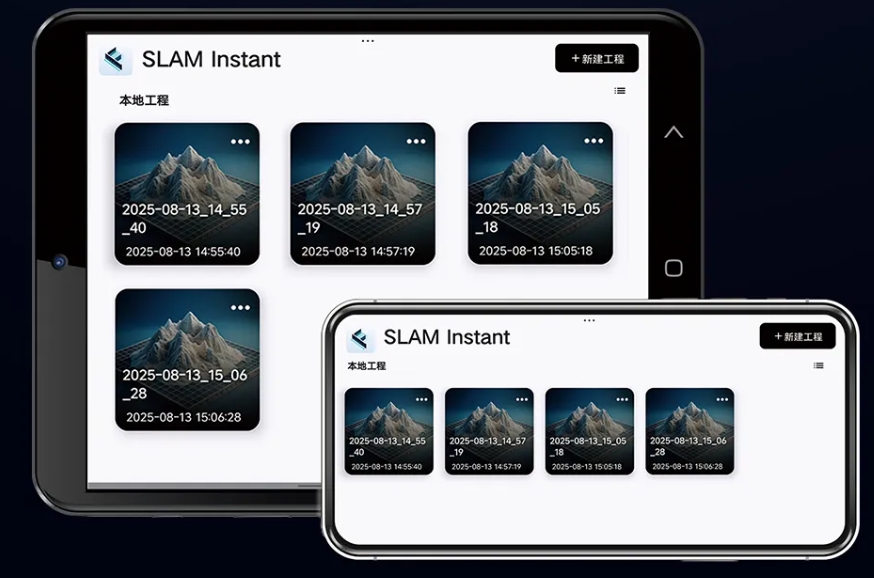
SLAM Instant APP
The SLAM Instant APP is a dedicated tool developed by Feima Robotics for instant field measurement. It can be installed on Android tablets, allowing users to quickly perform measurements and generate industry-specific survey reports immediately after completing field data acquisition.
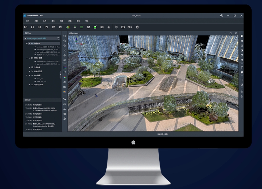
Slam Go Post Pro
SLAM GO POST Pro is the PC software companion for Feima Robotics’ entire series of handheld laser scanners, integrated into the professional version of Drone Manager. The software supports post-processing of SLAM200E data, generating high-precision, high-detail colored point clouds and local panoramic images, as well as enabling point cloud browsing and optimization.